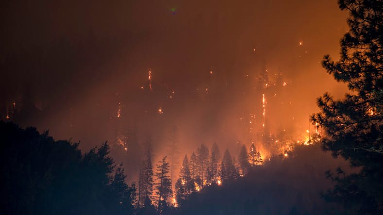
Last summer’s destructive wildfire season was California’s worst on record. Utility companies are searching for new ways to reduce the risk of electrical transmission equipment and power lines from igniting nearby foliage, leading to another wildfire.
As artificial intelligence is reimagining farming, biotech, and manufacturing, it is also being incorporated into firefighting and prevention of wildfires.
LiDAR (Light Detection and Ranging technology) emits laser-generated light pulses while flying over land. It then generates a 3-D topographical image using the measurement of the distance to earth combined with GPS data. Here’s a great overview of how LiDAR can help prevent hazardous wildfires.
Gregg Edeson at The Daily Beast has also previously discussed LiDAR for fighting fires:
“With the right software, LiDAR data can build 3D models of overhead power line infrastructure in relation to its terrain, allowing for measurement of clearance between wires and vegetation, indications of pole fatigue or damage, and even identification of sagging power lines. LiDAR can also be deployed on drones. Additionally, drones can capture images above utility assets that can be fed into machine learning programs which train to identify abnormalities with poles, insulators, conductors, and fuse switches.”
There are hundreds of thousand of miles of power lines in California that need to be monitored. If the FAA can grant permits quickly to long-range drones using LiDAR to monitor these lines, a repeat of last year’s devastating wildfires could be avoided.
Reality Changing Observations:
1. What are some other steps to take to prevent wildfires?
2. How can AI assist in evacuations and the logistics of timing evacuations?
3. How could LiDAR be utilized with other natural disasters?